Changing the International Territorial Level geography for Scotland: consultation analysis
The International Territorial Levels (ITLs) are geographic boundaries used in the production of statistics in the United Kingdom. This report presents an analysis of consultation responses and provides recommendations to the Office for National Statistics.
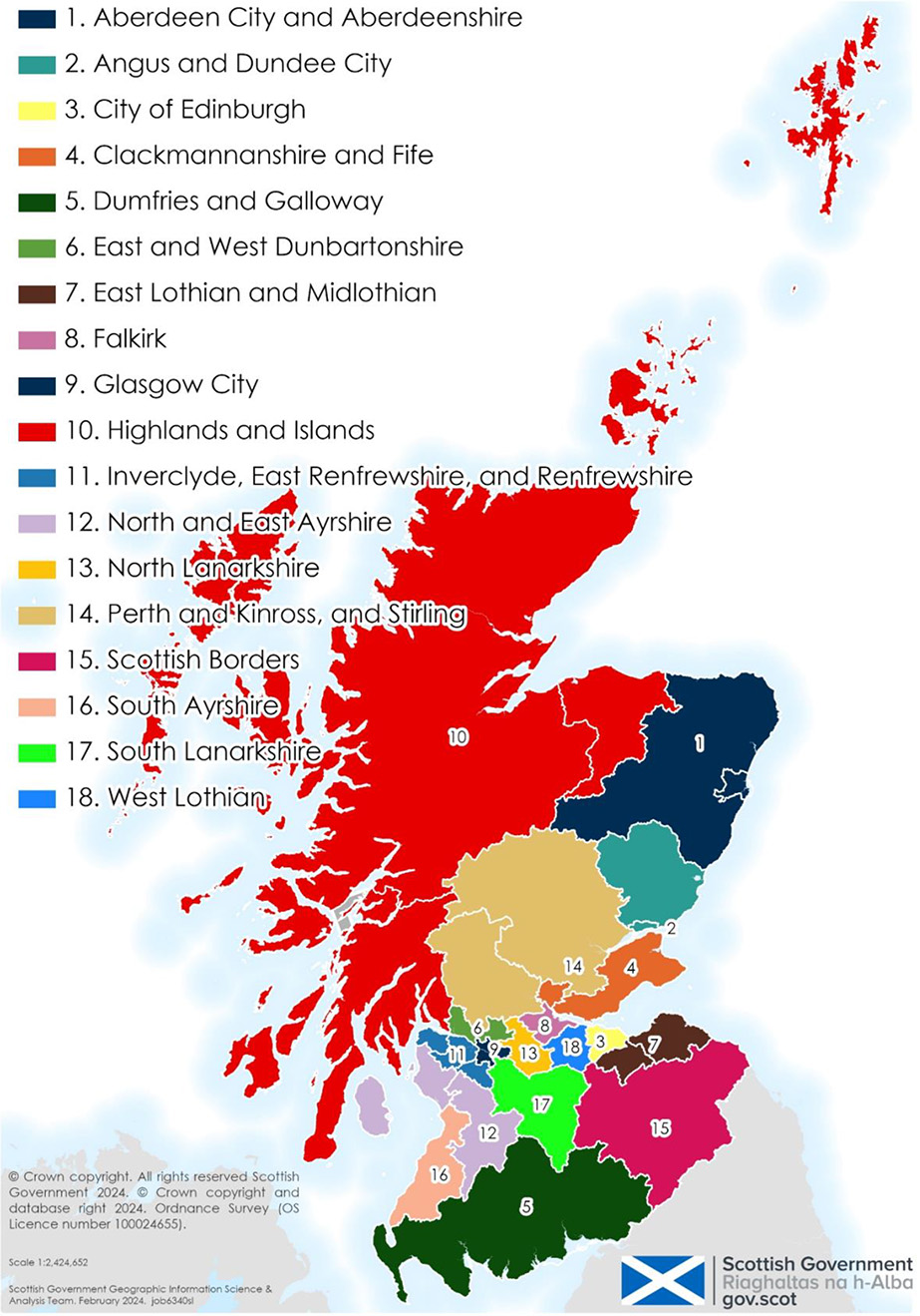
Figure 1: Proposed ITL3 Regions

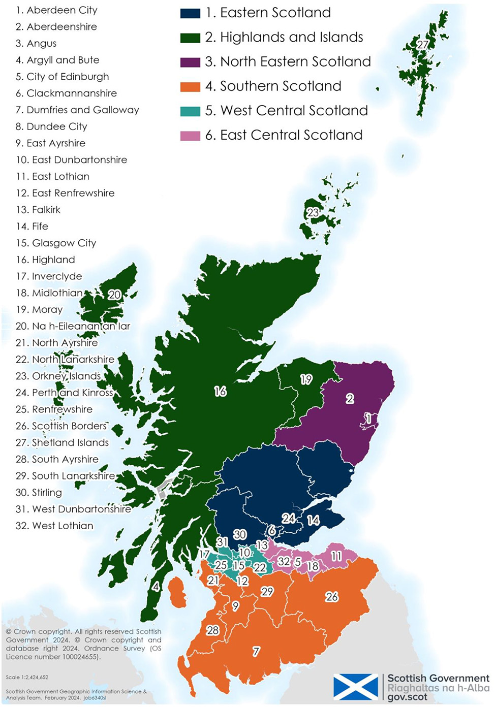
Figure 2: Proposed ITL2 regions

Contact
statistics.enquiries@gov.scot
There is a problem
Thanks for your feedback