Planning circular 1/2024: householder permitted development rights
Guidance on householder permitted development rights (PDR). It explains what works people can carry out to alter or improve their home without an application for planning permission.
3. Main Concepts
Overview
3.1 This section explains in detail the concepts that are fundamental to interpreting and applying PDR. These concepts are:
- “Principal elevation” is used to identify the front of the dwellinghouse.
- “Fronting a road” is a way of determining if the principal elevation, or side elevation, is in the public domain.
- “Front and rear curtilage” is a way of defining the area of land used for the comfortable enjoyment of the dwellinghouse.
- “Site coverage” is used to control the overall amount of ground covered by development.
- “Original or existing dwellinghouse”. The original dwellinghouse is the dwellinghouse as built or as it was on 1 July 1948 if it was built before then. The existing dwellinghouse is the house immediately before carrying out the proposed development.
- “Height and ground level”. How the height of development is measured.
3.2 Each of these is explained in more detail in this section of the document.
Principal Elevation
3.3 The term principal elevation is used to identify the "front" of a dwellinghouse. Whilst there are exceptions, most dwellinghouses are designed so that the "front" of the dwellinghouse faces a road.
3.4 Having established the principal elevation, the rear elevation will be the elevation opposite the principal elevation. Side elevations will link the principal and rear elevation.
Definition
3.5 The principal elevation is a reference to the elevation of the original dwellinghouse which by virtue of its design or setting, or both, is the principal elevation. Where it is not immediately obvious, a combination of the following factors should be used to identify the principal elevation:
- location of main door
- windows
- relationship to road
- boundary treatment
- architectural ornamentation
3.6 It is unlikely that any single factor will be decisive. The identification of the principal elevation should not be used to control development. There can only be one principal elevation. It is based on the design of the original dwellinghouse.
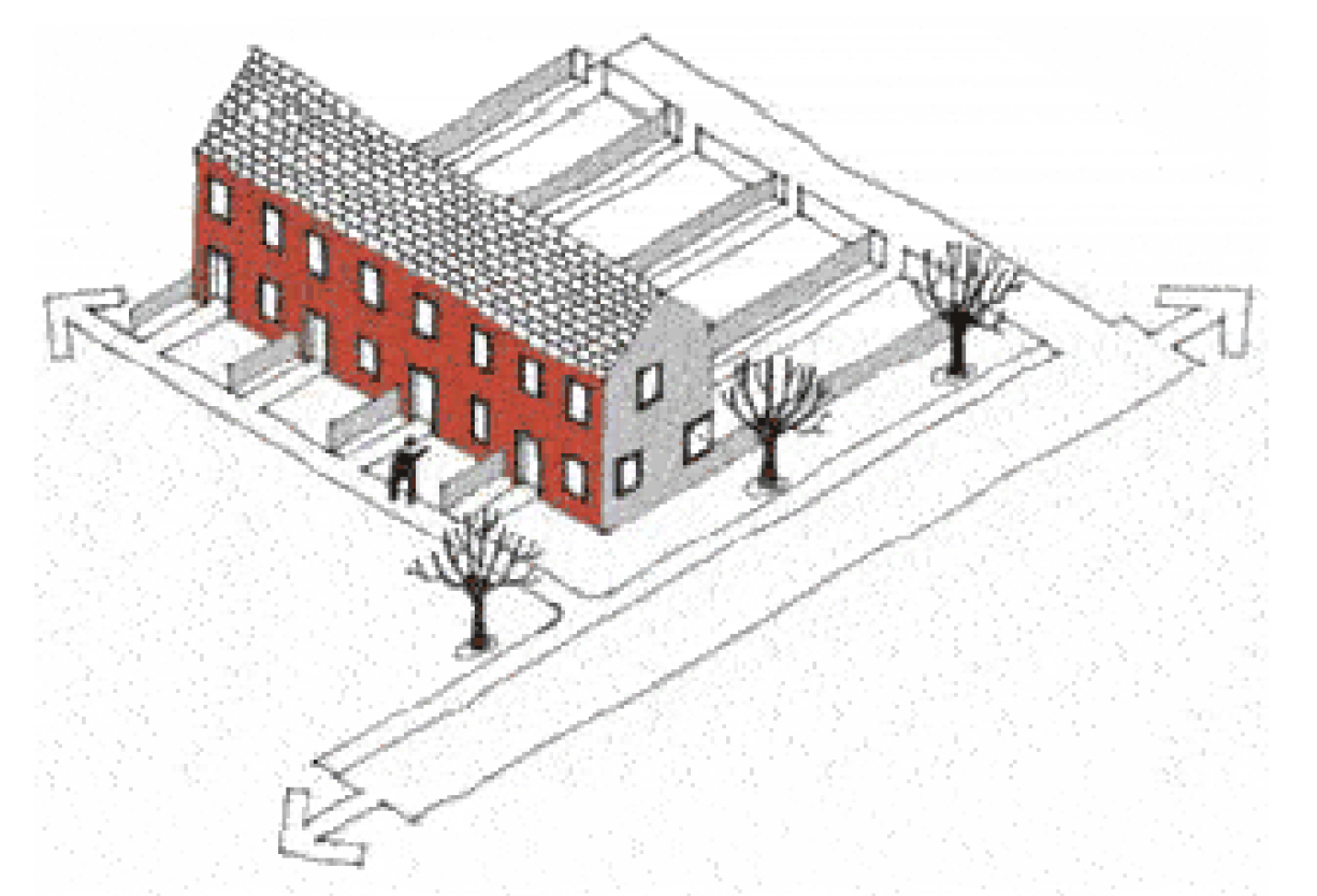
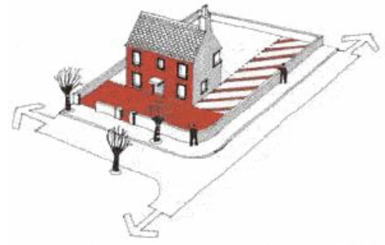
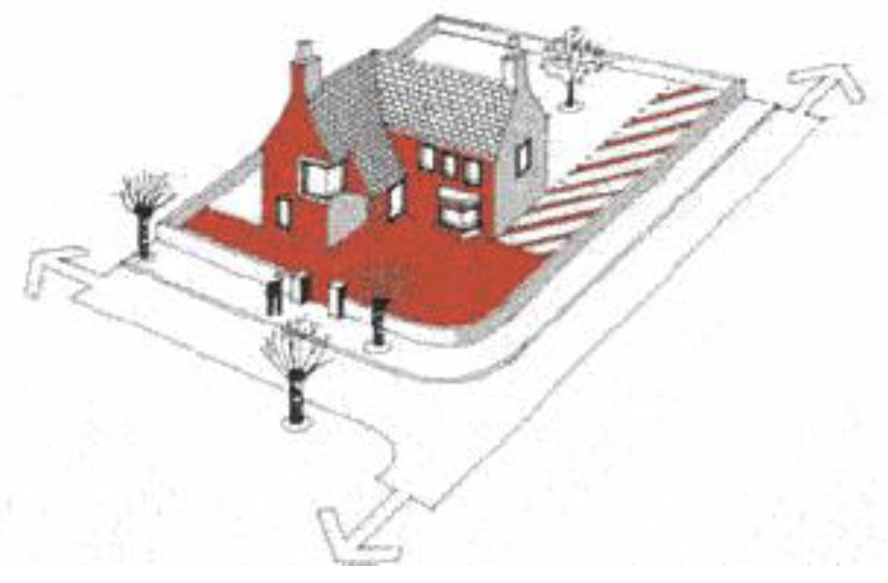
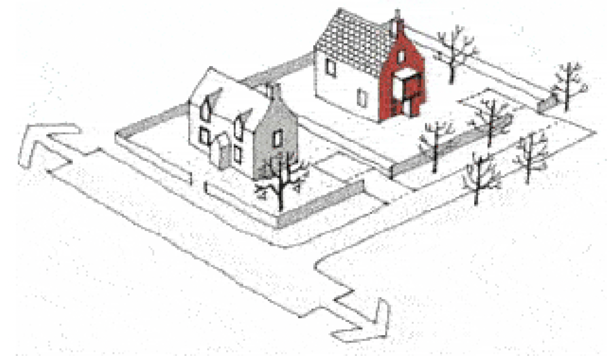
3.7 Figures 1 to 4 illustrate how the principal elevation can be identified in a variety of common situations.
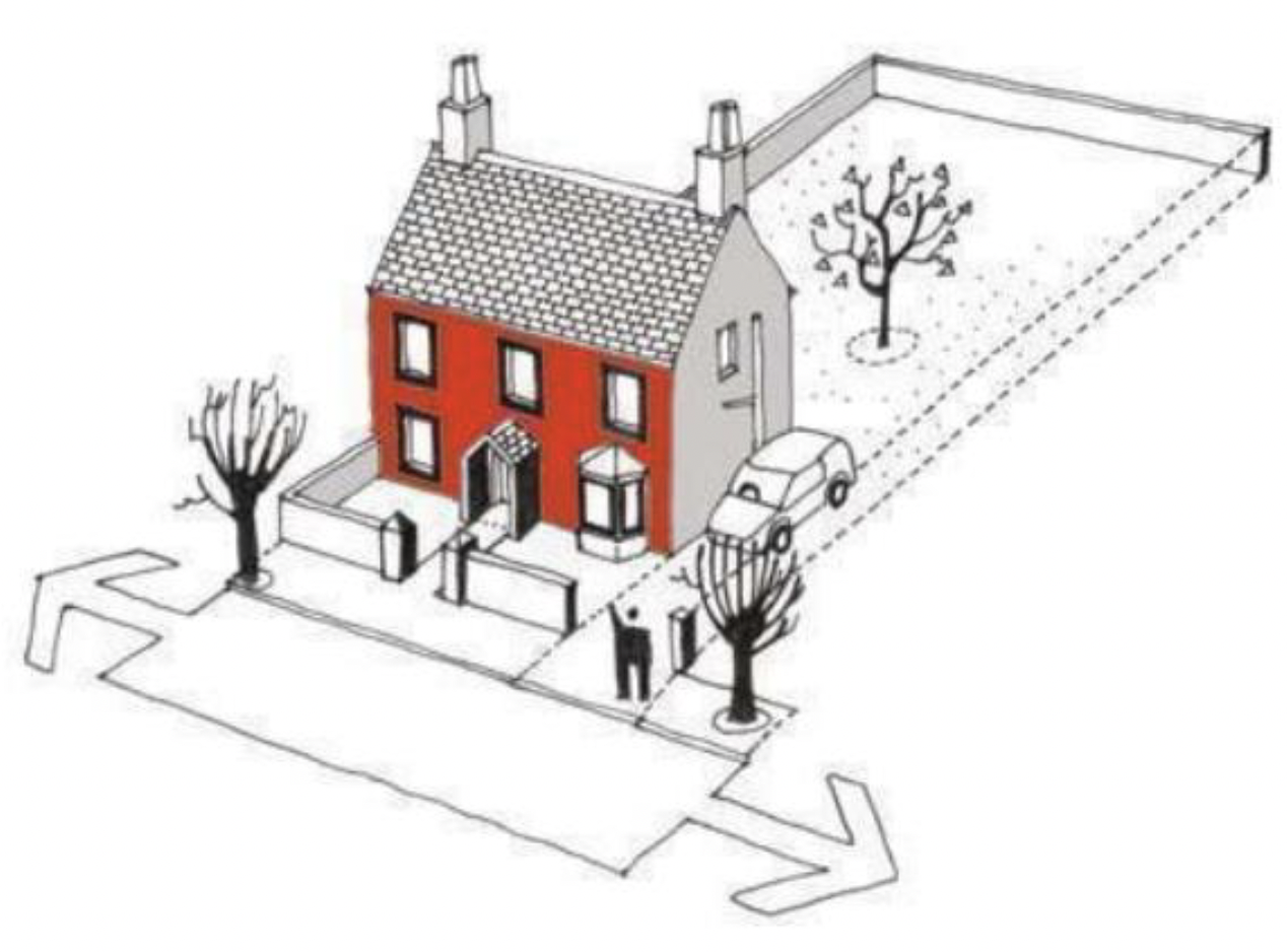
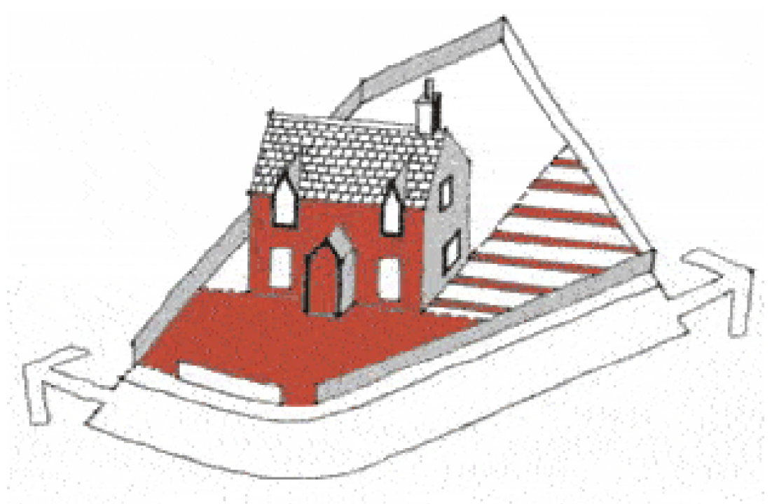
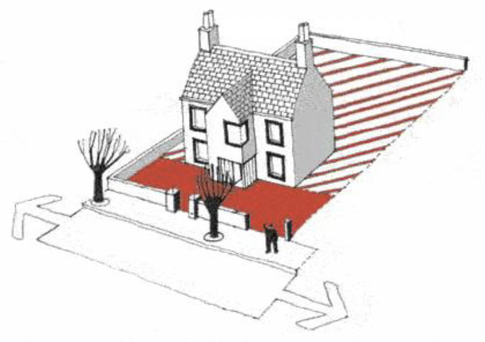
3.8 Figure 1: In this example the principal elevation is the elevation that fronts the road. It has the main door and is the obvious orientation of the dwellinghouse. The side elevation has fewer windows and has a shorter length. The rear area is more private with a higher fence.
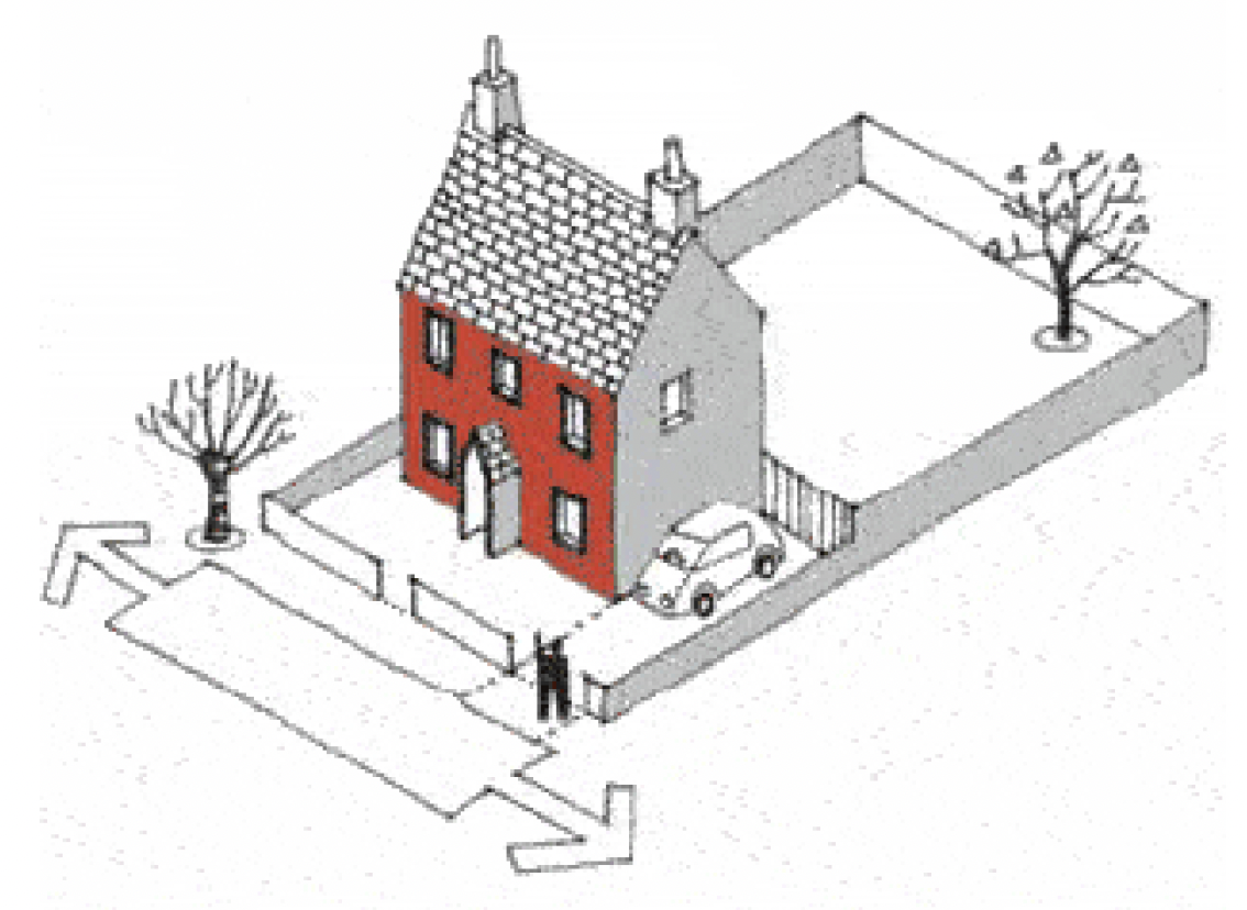
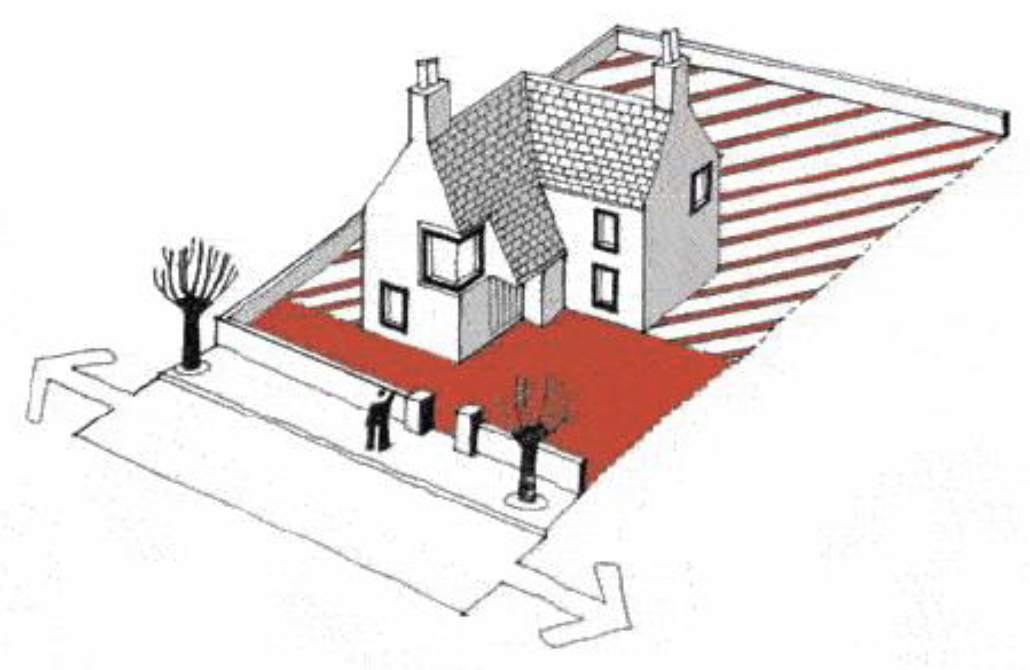
3.9 Figure 2: In this example the side elevation has the main door and a longer length, it has only a secondary window. The windows in the principal elevation show the main orientation of the dwellinghouse and it fronts the road. The boundary treatment indicates a more private rear area.
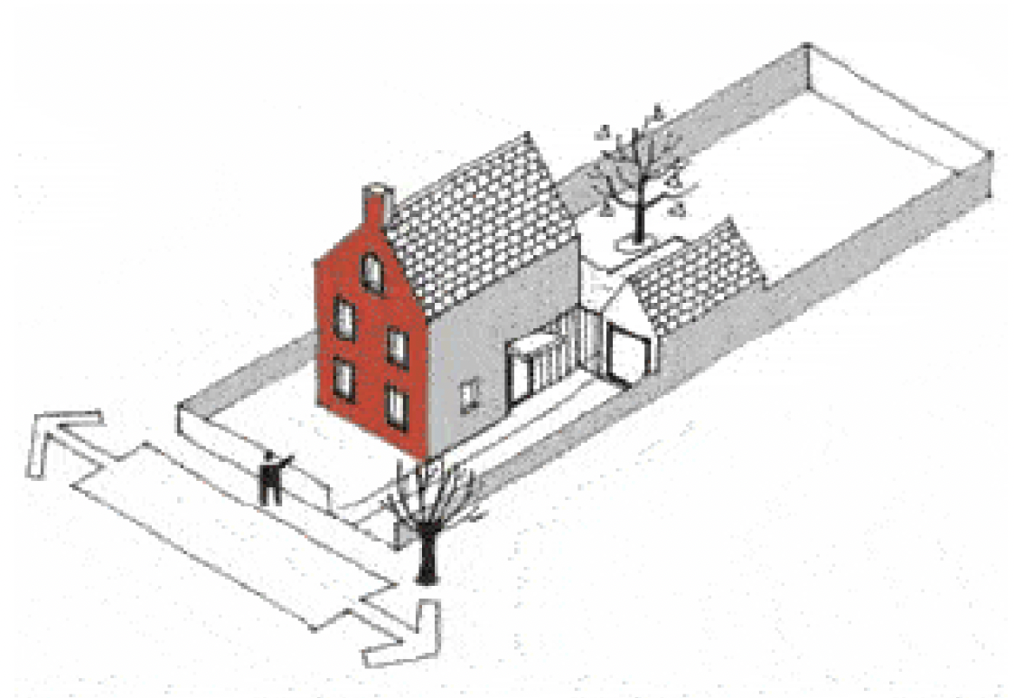
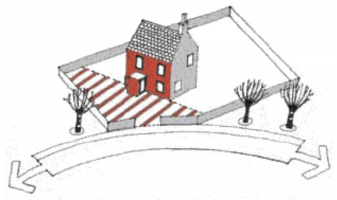
3.10 Figure 3: In this example the dwellinghouse on the corner plot will face two roads. However, the principal elevation has the main door and fronts the same road as the adjacent dwellinghouse. Opposite the principal elevation is the private rear area. The side elevation - although fronting a road and having windows - does not reflect the main orientation of the dwellinghouse.
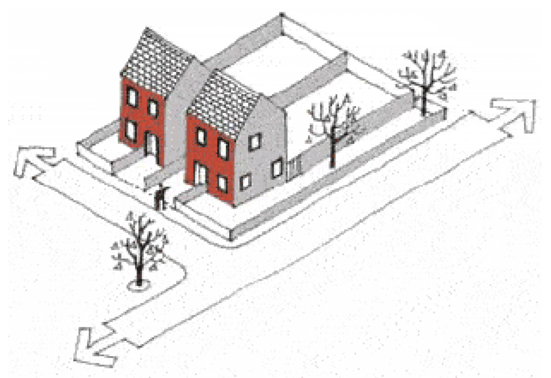
3.11 Figure 4: In this example of a Radburn-type layout the principal and rear elevations could be identical. However, the overall setting and boundary treatment indicates which elevation would be understood as the "front" and "rear". The side elevation has windows and faces a road but is not the principal elevation.
Fronting a Road
3.12 It is important to determine the relationship of the principal and side elevation to a road. In the context of the householder PDR, "Fronts" means facing onto a road and applies to both the principal and side elevation. It is determined by a number of factors including the angle of the dwellinghouse to the road, the distance between the dwellinghouse and the road and the size of any intervening land.
3.13 Fronting is used in a number of classes as a way of restricting PDR. Development is often not permitted if "any part of the development would be forward of a wall forming part of the principal elevation or side elevation…".
3.14 As illustrated in figures 5 and 6, an imaginary line can be drawn that extends from the principal elevation or side elevation to the boundary, this is the land forward of the principal elevation or side elevation.
3.15 Whilst figures 5 and 6, illustrate this concept in common circumstances, there will be situations where neither the principal nor the side elevation front a road. In such cases, development forward of a wall forming part of the principal elevation or side elevation may be permitted development subject to compliance with other criteria in any given class. Figures 7 to 11 illustrate situations where the principal elevation may not front a road.
3.16 Figure 7: Where there is no road. In this example, development would be permitted within any part of the curtilage of the dwellinghouse at the top of the diagram as long as it meets the site coverage, distance from boundary, height restrictions any other relevant restrictions for the type of development.
3.17 Figure 8: Where the dwellinghouse is sited at an angle. If an elevation is sited at an acute angle to a road, it may not be considered to front a road. In this illustration the dwellinghouse is judged to front a road. Any extension within the shaded areas would require an application for planning permission to the planning authority.
3.18 Figure 9: As the road bends, the side elevation no longer fronts the road. Any extension within the hatched areas would require an application for planning permission to the planning authority.
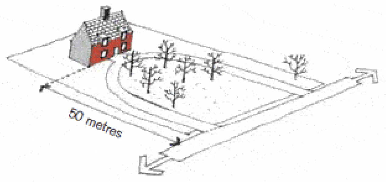
3.19 Figure 10: Within 20 metres of a road it is considered unlikely that any elevation could be argued to be too far from a road so that it no longer fronts a road. Beyond 30 metres from a road, it is increasingly likely that an elevation no longer fronts a road. For distances in between, a judgement would have to be made depending on fact and degree. This will involve considering factors such as topography, landscaping and layout of any adjacent properties. In this example, any developments would be permitted within the curtilage of the development as long as it meets the site coverage, distance from boundary, height restrictions and any other relevant restrictions for the type of development.
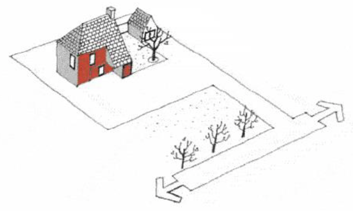
3.20 Figure 11: If there is intervening land between the curtilage of a dwellinghouse and a road, it could no longer be argued as fronting the road. In this example, any development would be permitted within the curtilage of the development as long as it meets the site coverage, distance from boundary, height restrictions and any other relevant restrictions for the type of development.
Front and Rear Curtilages
3.21 Once the principal elevation has been identified, the front and rear curtilages can be defined. The front curtilage is all the land forward of the principal elevation. The rear curtilage is the remainder of the curtilage of the original dwellinghouse. This may not reflect any physical division, like fences, that may exist.
Site Coverage
3.22 The size of any proposed extension, shed or other building must be such that the total area undeveloped is at least half of the rear or front curtilage. This is explained in figure 12 below. In most circumstances, the limitation will only relate to the rear curtilage. Where the principal or side elevation does not front onto a road, the limitation could also apply to the front curtilage.
3.23 There is also a restriction to ensure that the total area covered by all extensions (including previous extensions) is not greater than the area covered by the original dwellinghouse.
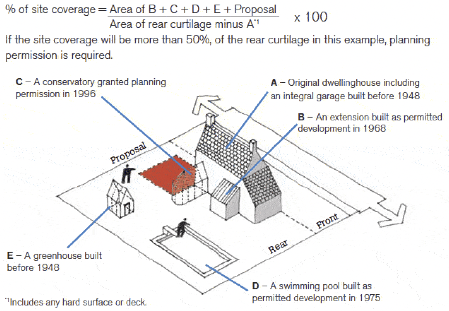
3.24 Figure 12: Calculating Site Coverage. In this example the total developed area comprises: the extension (B); conservatory (C) and swimming pool (D) since these developments occurred since 1948 , together with the greenhouse (E) as it was not attached to the original dwellinghouse.
3.25 Therefore, in this example:
Original or Existing Dwellinghouse
3.26 It is important to differentiate between the original dwellinghouse and the existing dwellinghouse.
3.27 The original dwellinghouse is the dwellinghouse as built or as it was on 1 July 1948 if it was built before then. The existing dwellinghouse is the dwellinghouse immediately before carrying out the development proposal that is being assessed. It does not include any outbuildings, even where they were built at the same time as the original dwellinghouse.
Heights and Ground Levels
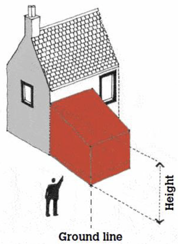
3.28 For the purposes of Classes 1A to 3E of the GPDO, the height of the development is measured from the lowest part of the surface of the ground adjacent to the building or structure.
3.29 In all other instances the height of the building or structure is calculated from the highest part of the surface of the ground immediately adjacent to the building or structure.
3.30 The ground is the natural ground and would not include any addition laid on top of the natural ground.
Contact
Email: Chief.Planner@gov.scot
There is a problem
Thanks for your feedback