Draft Fisheries Assessment – Turbot Bank NCMPA: Fisheries management measures within Scottish Offshore Marine Protected Areas (MPAs)
These assessments look at the fishing activity occurring within each offshore MPA and SAC and assess the potential impacts of this activity on the protected features within each site. This assessment is for Turbot Bank NCMPA.
1. Introduction
1.1 Scope of the Turbot Bank NCMPA assessment
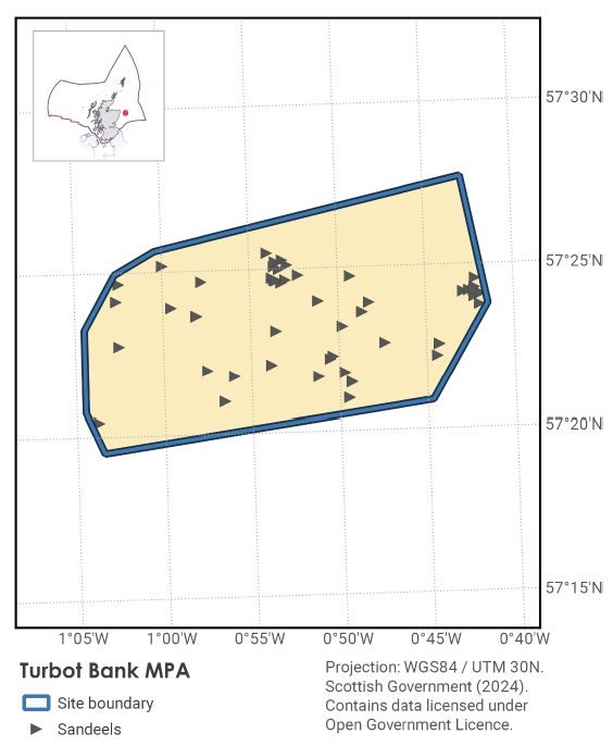
The geographic scope of this assessment covers the whole of Turbot Bank NCMPA (Figure 1). The purpose of this assessment is to determine whether the current levels of fishing activities would or might hinder the conservation objectives of Turbot Bank NCMPA and to identify options for management measures.
In this assessment, Scottish Ministers use the best available evidence to review the site characteristics and current fishing activity (Part A), both taken alone and in combination with other relevant activities (Part C) to determine if the fishing activities are capable of impacting the protected feature (sandeel). Any fishing activities capable of impacting the protected feature, either alone or in combination with other relevant activities, are considered further to assess whether they would or might hinder the achievement of the conservation objectives (Part B).
Where there is the potential for the achievement of the conservation objectives to be hindered, management measures are identified for the site by Scottish Ministers. These measures are considered in light of the conservation objectives, biological characteristics, current fishing activity, other activity levels and existing fisheries restrictions for Turbot Bank MPA. A final decision on which measures, if any, are to be adopted, will follow upon a statutory consultation exercise and will take into account all relevant statutory obligations incumbent upon Scottish Ministers.
A methodology document has been prepared to aid understanding of these assessments.
1.2 Site description
Located off the east coast of Scotland, the Turbot Bank NCMPA lies within an area of sandy sediment, including part of the shelf bank and mound feature known as 'Turbot Bank'. Turbot bank had been designated in 2014 as a Nature Conservation MPA (NCMPA).
Turbot Bank is important for sandeel which are closely associated with sand habitats, living buried in the sand for months at a time. The Turbot Bank NCMPA encompasses areas where high numbers of sandeel have been found, since it hosts the type of sandy sediment in which they prefer to bury themselves. Sandeel play an important role in the wider North Sea ecosystem, providing a vital source of food for larger fish, seabirds and marine mammals. Turbot Bank NCMPA has the potential to act as a source of young sandeel (larvae) for maintaining and restocking surrounding areas.
The Conservation Objective for the Turbot Bank Nature Conservation Marine Protected Area is that the protected feature (sandeel) listed below;
- so far as already in favourable condition, remain in such condition; and
- so far as not already in favourable condition, be brought into such condition, and remain in such condition.
With respect to the sandeel, this means that the quality and quantity of its habitat and the composition of its population are such that they ensure that the population is maintained in numbers which enable it to thrive. Any temporary reduction of numbers is to be disregarded if the population of sandeel is thriving and sufficiently resilient to enable its recovery from such reduction. Any alteration to that feature brought about entirely by natural processes is to be disregarded.
For sandeel, the feature condition has been assessed by JNCC as being in ‘Favourable’ condition. More information regarding the conservation objectives for Turbot Bank NCMPA is available within the site’s conservation advice package available on JNCC’s site information centre.
1.3 Activities assessed
The assessments consider the impacts of fisheries activities at each NCMPA in terms of the conservation objectives stated for the designated sites. This was deemed appropriate, in order to assist in identifying potential management measures.
In this context, the implications of the fishing activity in view of the conservation objectives for the NCMPA are being assessed through the fisheries screening stage (Part A), the fisheries assessment (Part B), and the in combination (cumulative effect) assessment (Part C).
Fisheries assessments use the best available evidence to fully consider potential impacts of commercial fishing activity, and in-combination (cumulative) effects with other activities, against the conservation objectives for the site. If the assessment concludes that use of certain fishing gear types would or might hinder the achievement of the conservation objectives of the site, management measures will be considered.
Commercial sea fishing activity has the potential to vary in nature and intensity over time. This assessment considers fishing activity based on activity levels and type between 2015-2019. This date range was considered to provide the best available data on current fishing activity levels for the assessment. Using a five-year date range provides an average view of fishing activity within the site; latter years (2020 – 2021) were not considered representative of regular fishing activity due to the Covid pandemic. The selected date range (2015 – 2019) was used consistently across all assessments within the consultation package. Changes in fishing activity after this time period may be considered in future reviews of this assessment (see Section 6).
Contact
Email: marine_biodiversity@gov.scot
There is a problem
Thanks for your feedback