Draft Fisheries Assessment – West Shetland Shelf NCMPA: Fisheries management measures within Scottish Offshore Marine Protected Areas (MPAs)
These assessments look at the fishing activity occurring within each offshore MPA and SAC and assess the potential impacts of this activity on the protected features within each site. This assessment is for West Shetland Shelf NCMPA.
1. Introduction
1.1. Scope of the West Shetland Shelf NCMPA assessment
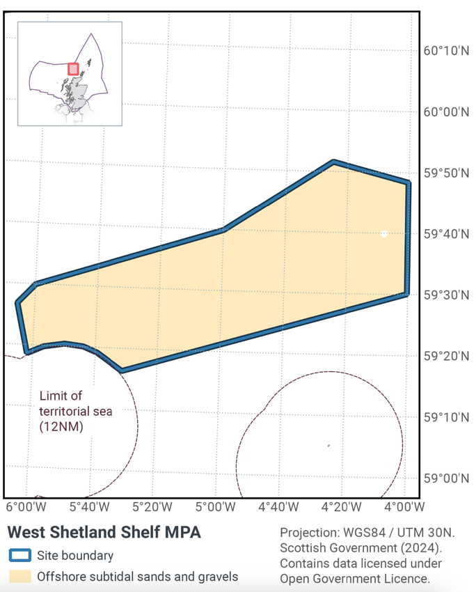
The geographic scope of this assessment covers the whole of the West Shetland Shelf NCMPA, located in the Scottish offshore region (Figure 1). The purpose of this assessment is to determine whether the current levels of fishing activity would or might hinder the conservation objectives of the West Shetland Shelf NCMPA, and to identify options for management measures.
In this assessment, the Scottish Ministers use the best available evidence to review the site characteristics and current fishing activity (Part A), both taken alone and in combination with other relevant activities (Part C) to determine if the fishing activities are capable of affecting the protected feature (Offshore subtidal sands and gravels). Any fishing activities capable of affecting the protected features, either alone or in combination with other relevant activities, are considered further to assess whether they would or might hinder the achievement of the conservation objectives (Part B).
Where there is the potential for the achievement of the conservation objectives to be hindered, management measures are identified for the site by the Scottish Ministers. These measures are considered in light of the conservation objectives, biological characteristics of protected features, current fishing, other activity levels and existing fisheries restrictions for West Shetland Shelf NCMPA. A final decision on which measures, if any, are to be adopted, will follow upon a statutory consultation exercise and will take into account all relevant statutory obligations incumbent upon Scottish Ministers.
A methodology document has been prepared to aid understanding of these assessments.
1.2. Site description
West Shetland Shelf Nature Conservation MPA (Figure 1) is located to the north of Scotland, with water depth of 70 – 150 m deep. The entirety of the site lies within the Scottish offshore region.
The site has been designated for the protection of the wide variety of sand and gravel habitats (habitats of priority importance) present in the area (Table 1; Figure 1), providing an important example of the northern extent of their range on the continental shelf in Scottish seas. The MPA protects an area of 4083 km2.
Although a relatively common habitat in Scottish seas, the range of different types of sand and gravel habitats present within the MPA supports a particularly rich diversity of wildlife. On the surface anemones, cup sponges (Axinella infundibuliformis) and several types of crustaceans including hermit crabs and squat lobster (Munida rugosa) can be found living between small rocks, whilst urchins and starfish (such as Porania (Porania) pulvillus and Asterias rubens) are typical fauna living on the surface of sandier sediments. Bryozoans and encrusting sponges are often found growing on the surface of cobbles and pebbles. Sea snails and bivalves, such as scallops, keel worms, and sand mason worms (Lanice conchilega), are adapted to living buried in the sand to avoid predators.
The area enclosed within the MPA is also important for several species of fish, including the dragonet (Callionymus lyra), red gurnard (Chelidonichthys cuculus), cod (Gadus morhua), plaice (Pleuronectes platessa), bass (Dicentrarchus labrax), and skate and rays (e.g. Leucoraja naevus).
The West Shetland Shelf NCMPA offshore subtidal sands and gravels protected feature encompasses a range of sub-components, including the EUNIS Level 4 habitats circalittoral coarse sediments, circalittoral mixed sediments, and circalittoral sands (JNCC, 2014). West Shetland Shelf NCMPA is significant in representing offshore subtidal sand and gravel habitats in OSPAR Regions II & III on the continental shelf at the northern extent of its range in both OSPAR Regions.
The conservation objective for the West Shetland Shelf NCMPA is that the protected feature (offshore subtidal sands and gravels):
- so far as already in favourable condition, remain in such condition; and
- so far as not already in favourable condition, be brought into such condition, and remain in such condition.
With respect to offshore subtidal sands and gravels in the site, this means that:
- extent is stable or increasing; and
- structure and function, quality, and the composition of characteristic biological communities (which includes a reference to the diversity and abundance of marine flora and fauna forming part of or inhabiting that habitat) are such as to ensure they remain in a condition which is healthy and not deteriorating;
any temporary deterioration in condition is to be disregarded if the habitat is sufficiently healthy and resilient to enable its recovery from such deterioration. Any alteration to that feature brought about entirely by natural processes is to be disregarded.
The condition of the offshore subtidal sands and gravels feature at West Shetland Shelf NCMPA has been assessed by JNCC as favourable (JNCC, 2020). More information on the condition of the subtidal sands and gravels feature and conservation objectives of the West Shetland Shelf NCMPA is available in the West Shetland Shelf NCMPA – Conservation Advice 2018. The subtidal sands and gravels feature extends to the entirety of the MPA, which has a total area of 4,083 km2.
1.3. Activities assessed
The assessments consider the impacts of fisheries activities at each NCMPA in terms of the conservation objectives stated for the designated sites. This was deemed appropriate, in order assist in identifying potential management measures.
In this context, the implications of the fishing activity in view of the conservation objectives for the MPA are being assessed through the fisheries screening stage (Part A), the fisheries assessment (Part B), and the in combination (cumulative effect) assessment (Part C).
Fisheries Assessments use the best available evidence to fully consider potential impacts of commercial fishing activity, and in-combination (cumulative) effects with other activities, against the conservation objectives for the site. If the assessment concludes that use of certain fishing gear types would or might hinder the achievement of the conservation objectives of the site, management measures will be considered.
Commercial sea fishing activity has the potential to vary in nature and intensity over time. This assessment considers fishing activity based on activity levels and type between 2015-2019. This date range was considered to provide the best available data on current fishing activity levels for the assessment. Using a five-year date range provides an average view of fishing activity within the site; latter years (2020 – 2021) were not considered representative of regular fishing activity due to the Covid pandemic. The selected date range (2015 – 2019) was used consistently across all assessments within the consultation package. Changes in fishing activity after this time period may be considered in future reviews of this assessment (see Section 6).
Contact
Email: marine_biodiversity@gov.scot
There is a problem
Thanks for your feedback