Extending marine planning zones: consultation
Consultation paper on proposals to extend marine planning zones out to 12 nautical miles
Background
In 2007 the definition of “development” in the Town and Country Planning (Scotland) Act 1997 (“the 1997 Act”) was amended to include fish and shellfish farming out to 12 nautical miles. This means that any proposed marine fish or shellfish farm located between 0-12 nautical miles requires planning permission from the relevant planning authority.
However, the Town and Country Planning (Marine Fish Farming) (Scotland) Order 2007 (“the 2007 Order”) only designated Scotland’s marine planning zones out to 3 nautical miles. Full details on the policy intention and approach to designating the marine planning zones can be viewed in the Consultation Paper on Defining Marine Boundaries for Fish Farming, published on 31 October 2005.
In practice, this means that there is no designated planning authority to which a developer may submit an application for a farm located between 3-12 nautical miles.
When the marine planning zones were first designated in 2007, it was considered highly unlikely that applications for planning permissions between 3-12 nautical miles would be lodged in the near future. It was therefore noted in Planning Circular 1/2007: Planning Controls for Marine Fish Farming that the Scottish Executive would monitor the situation, with further work envisaged during subsequent years to extend the marine planning zones out to 12 nautical miles. This work was not undertaken and as such there remains a legislative gap.
An illustrative map of the current marine planning zones is provided below:
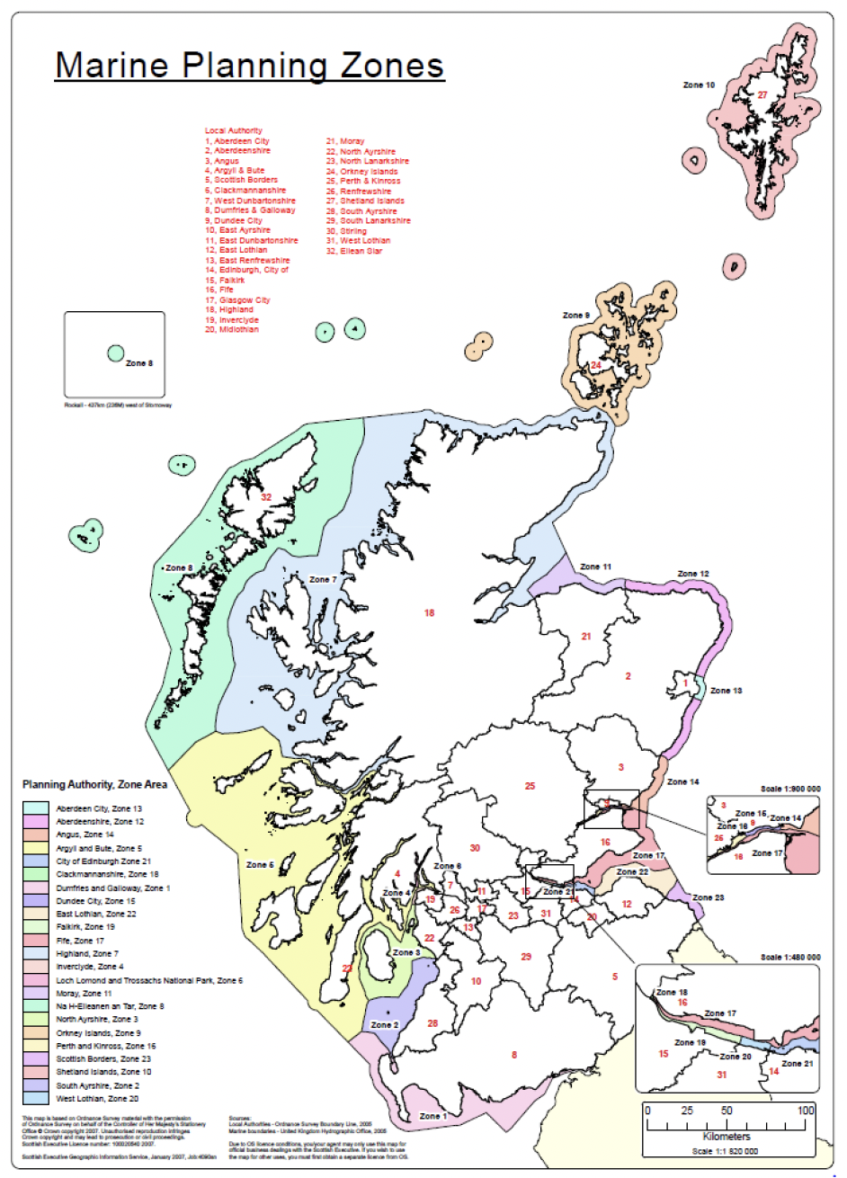
This map is based on Ordnance Survey material with the permission of Ordnance Survey on behalf of the Controller of Her Majesty's Stationery Office © Crown copyright 2007. Unauthorised reproduction infringes Crown copyright and may lead to prosecution or civil proceedings.
Scottish Executive Licence number: 100020540 2007.
Scottish Executive Geographic Information Service, January 2007, Job:4090sn
Sources:
Local Authorities - Ordnance Survey Boundary Line, 2005
Marine boundaries - United Kingdom Hydrographic Office, 2005
Due to OS licence conditions, you/your agent may only use this map for official business dealings with the Scottish Executive. If you wish to use the map for other uses, you must first obtain a separate licence from OS.
An interactive map of the current marine planning zones can also be viewed on the marine.gov.scot NMPi. Additional information about the map layer can be viewed at Aquaculture - Planning Zones for Marine Fish Farming | marine.gov.scot
Contact
Email: AquacultureReview@gov.scot
There is a problem
Thanks for your feedback