Fisheries Management Measures within Scottish Offshore Marine Protected Areas (MPAs) - Site Proposal Document
This document describes the process, justification and evidence used to develop site specific management measures. It outlines key information for each site including their features, and risks of potential pressures.
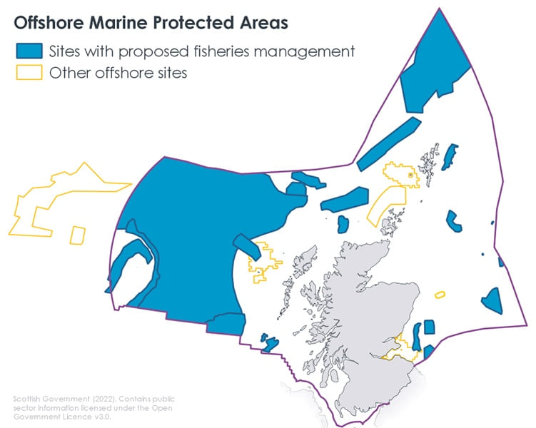
2. Sites
2.1 Sites covered
There are 27 sites (MPAs, SACs with marine components and SPAs with marine components) in the Scottish offshore region. Of these, 20 sites are considered to require fisheries management measures to support the achievement of site conservation objectives. These 20 sites are listed Table 3 and Table 4.
Site name |
Designation |
|---|---|
Braemar Pockmarks |
SAC |
Central Fladen |
MPA |
East of Gannet and Montrose Fields |
MPA |
Faroe-Shetland Sponge Belt |
MPA |
Firth of Forth Banks Complex |
MPA |
North-East Faroe-Shetland Channel |
MPA |
Norwegian Boundary Sediment Plain |
MPA |
Pobie Bank Reef |
SAC |
Scanner Pockmark |
SAC |
Site name |
Designation |
|---|---|
Anton Dohrn Seamount |
SAC |
Darwin Mounds |
SAC |
East Rockall Bank |
SAC |
Geikie Slide and Hebridean Slope |
MPA |
North West Rockall Bank |
SAC |
Solan Bank Reef |
SAC |
Stanton Banks |
SAC |
The Barra Fan and Hebrides Terrace Seamount |
MPA |
West of Scotland |
MPA |
West Shetland Shelf |
MPA |
Wyville-Thomson Ridge |
SAC |
There are three Special Protection Areas (SPAs) for marine birds which have some overlap with the offshore and inshore region. These sites are the Seas off St Kilda, Seas off Foula, and the Outer Firth of Forth and St Andrews Bay Complex which are designated for protecting important feeding grounds for seabirds. Scottish Government will consider these three sites and progress their recommended fisheries management measures with the inshore work programme.
Three NCMPAs (Hatton Rockall Basin MPA, Turbot Bank MPA and North-West Orkney MPA) are not considered to require fisheries management measures. Hatton Rockall Basin MPA is located in the NEAFC waters, and it falls outside the existing fishing area footprint, this means fishing could only take place after an Environmental Impact Assessment. Turbot Bank MPA and North-West Orkney MPA are designated for sandeel and do not require further fisheries management measures to protect the feature as targeted fishing for sandeel is not permitted within Scottish waters.
Measures were initially developed for Turbot Bank MPA which would restrict targeted sandeel within the site however The Sandeel (Prohibition Of Fishing) (Scotland) Order 2024 came into force on 26 March 2024 ahead of the 2024 fishery season and applies to all vessels (UK and EU) fishing within Scottish waters. JNCC consider Sandeels to be in favourable condition within this MPA and that in the absence of a targeted Sandeel fishery, no additional management of fishing activity is necessary to achieve the conservation objective for the Sandeel feature for Turbot Bank MPA.
In addition Hatton Bank is an SAC currently managed by the NEAFC, this is considered to be well managed so no further fisheries management measures are required.
2.2 Overview of changes since 2017
For the majority of sites, fisheries management proposals were developed under the process outlined in the EU Common Fisheries Policy. These were however put on hold in the lead up to EU exit as the required agreement from EU Member States with a direct management interest was not secured. These proposals were developed with stakeholders between 2013-2017. Meeting notes from these workshops are available online.
For some sites, fisheries management proposals were developed or implemented separately. This covers Darwin Mounds SAC (where an emergency fisheries closure was introduced in 2003 to protect deep-water coral reefs and became permanent in 2004), and North West Rockall Bank SAC (partially subject to NEAFC closure).
The evidence base supporting the site management proposals has changed for some sites since 2017. Minor changes to proposals have therefore been made and discussed with stakeholders. Additionally, some designations have changed, namely the designation of West of Scotland MPA and consequential de-designation of Rosemary Bank Seamount MPA. The changes since proposals were previously published are summarised in Table 5 and discussed further in the sections below.
The EU Cod Recovery Plan measures which restricted mobile gear from 2003 – 2019 the West Shetland Shelf MPA were lifted in 2019, subsequently further measures were required. These were developed with SNCBs and stakeholders. Meeting minutes for this workshop are available online.
Site Name |
Evidence changes |
Summary of management changes |
|---|---|---|
East Rockall Bank SAC |
Annex I Reef habitat found outside initial proposed closed area |
Additional zonal restrictions to static gear under Option 1 |
Faroe – Shetland Sponge Belt MPA |
Multiple new records of Deep-sea sponge aggregations outside initial proposed closed area |
Amend initial proposed management measure boundary accordingly under Option 1 |
Stanton Banks SAC |
Annex I Reef habitat found outside initial proposed closed area |
Amend initial proposed management measure boundary accordingly under Option 1 |
West Shetland Shelf MPA |
None – previous fisheries measures that were in place through EU Cod Recovery Plan were lifted in 2019 |
Fisheries management measures to be put in place to replace lifted measures |
2.3 JNCC Fisheries Management Advice
A range of management levels are available to managers, which differ in the degree of restriction they would place on fishing operations and the risk they would pose to the achievement of the conservation objectives. Three broad categories of possible management are considered.
For each of these broad management categories, JNCC have evaluated the level of risk posed to the achievement of the conservation objectives. It is not generally possible to quantify the degree of risk posed by each management option; however JNCC have indicated where they consider that a risk exists, where it would be ‘significant’, and where it would be reduced by application of management. In most cases JNCC have not recommended a single preferred option but would advise that fisheries managers and stakeholders consider the identified levels of risk when further developing management measures.
Risks were evaluated using existing data and information on protected features and relevant activities, and also the understanding of the relationships between the feature and relevant activities. The identification of the risk has been refined using available information on the interaction between the features and activities where this is available. The text focuses on interactions in terms of geographical overlap but the assessment of risk in future should also take account of the intensity and frequency of activities within the MPA.
A gradient of management options has been considered. These have been described under three potential management option categories:
a) No additional management - where fisheries managers choose to apply no additional site specific fisheries management within the site
b) Additional management to reduce pressures – where fisheries managers may wish to consider a range of measures that could be used to reduce the risk to features by managing fishing activity. These could include:
- Area restrictions (permanently closing some or all of the features’ area)
- Temporal restrictions (e.g. closing some or all of the MPA at specified periods to protect key life history stages)
- Gear restrictions (e.g. restricting use of the more damaging gears)
Ideally, any measures would generally apply only to the parts of the sites where the vulnerable feature is present. However, there may be some circumstances in which it could be desirable to extend management measures beyond the known area of feature distribution, for example, where conditions are suitable for a feature to exist but there are insufficient data to confirm its presence.
In situations where there is high uncertainty regarding the impacts of fishing on the features, these management measures could be “adaptive” i.e. following introduction of management measures, changes in the features’ condition could be monitored and future management may be adapted accordingly.
c) Additional management to remove pressures – where fishing activities known to adversely affect the feature would be excluded. Such exclusion would generally apply only to the parts of the sites where the feature is present, although it may occasionally be necessary to apply them to a wider area.
JNCC and MD recognise that stakeholders can provide local environmental knowledge and more detailed information on activities, including distribution and intensity of effort, frequency of activity, and fishing methods employed. This additional information helps develop more specific management measures, focused on interactions between features and activities.
The full management advice provided for each site is available on the JNCC website on JNCC’s Resource Hub.
Contact
Email: marine_biodiversity@gov.scot
There is a problem
Thanks for your feedback