Fisheries Management Measures within Scottish Offshore Marine Protected Areas (MPAs) - Strategic Environmental Assessment Environmental Report

This assessment is undertaken to identify and assess any likely environmental effects of the policy and its alternatives.


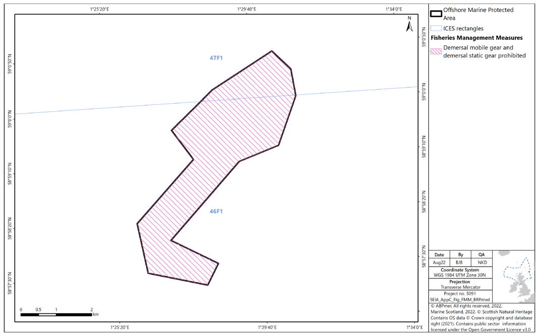
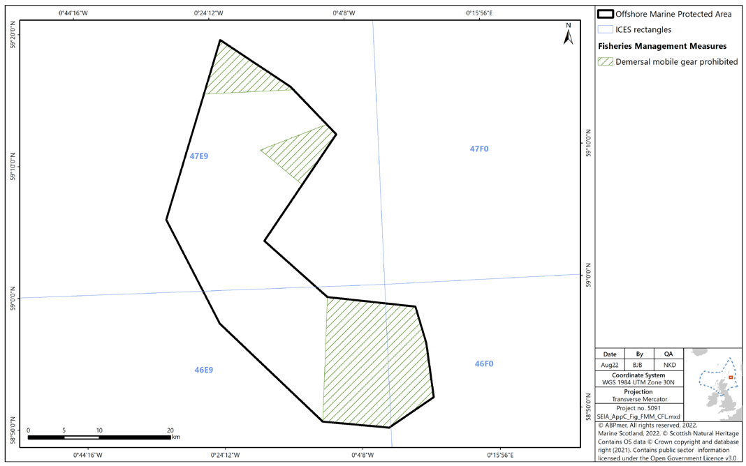
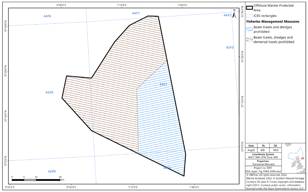
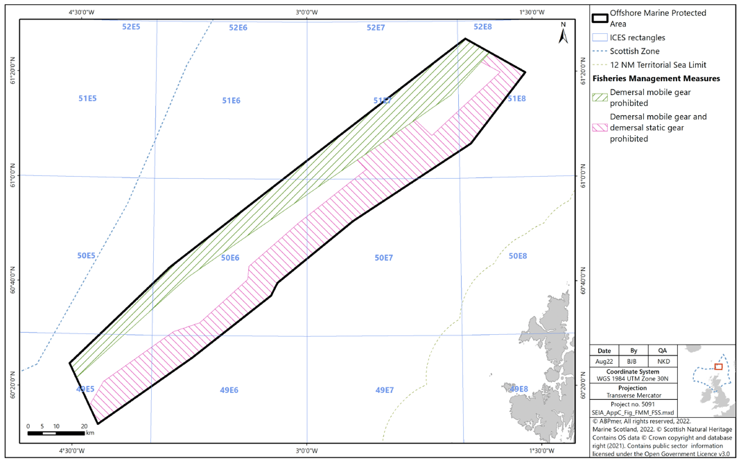
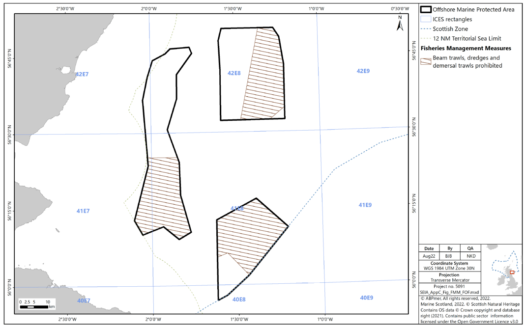
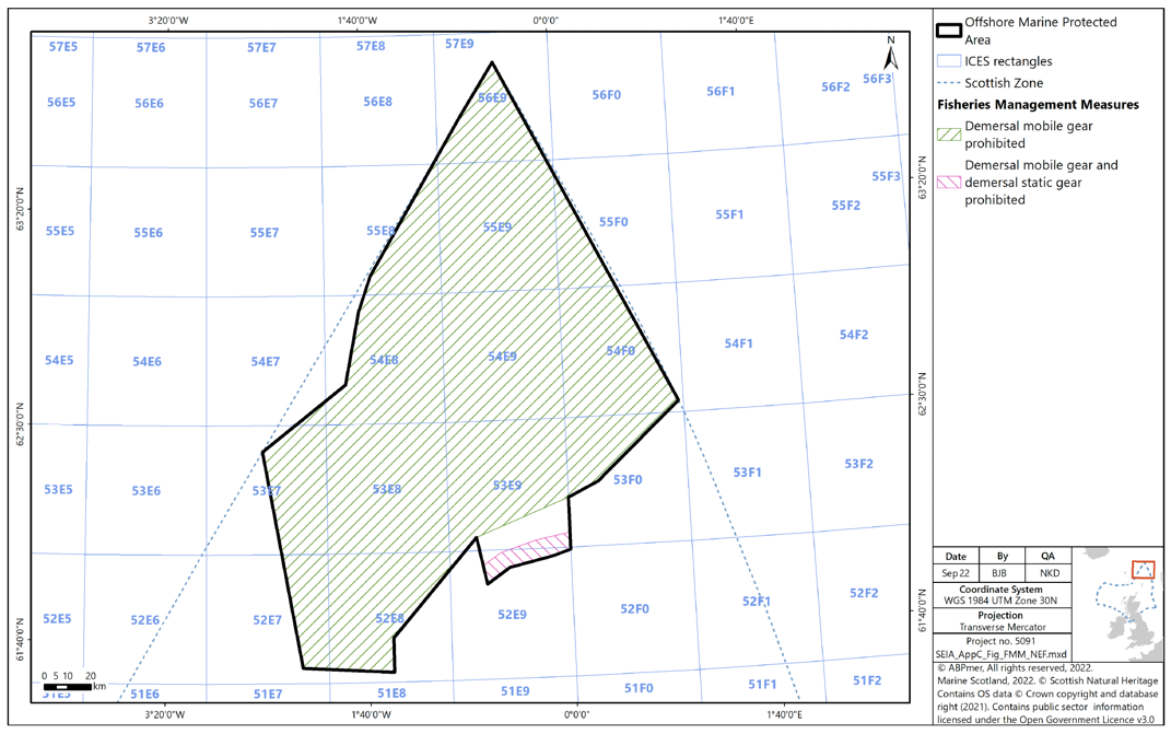
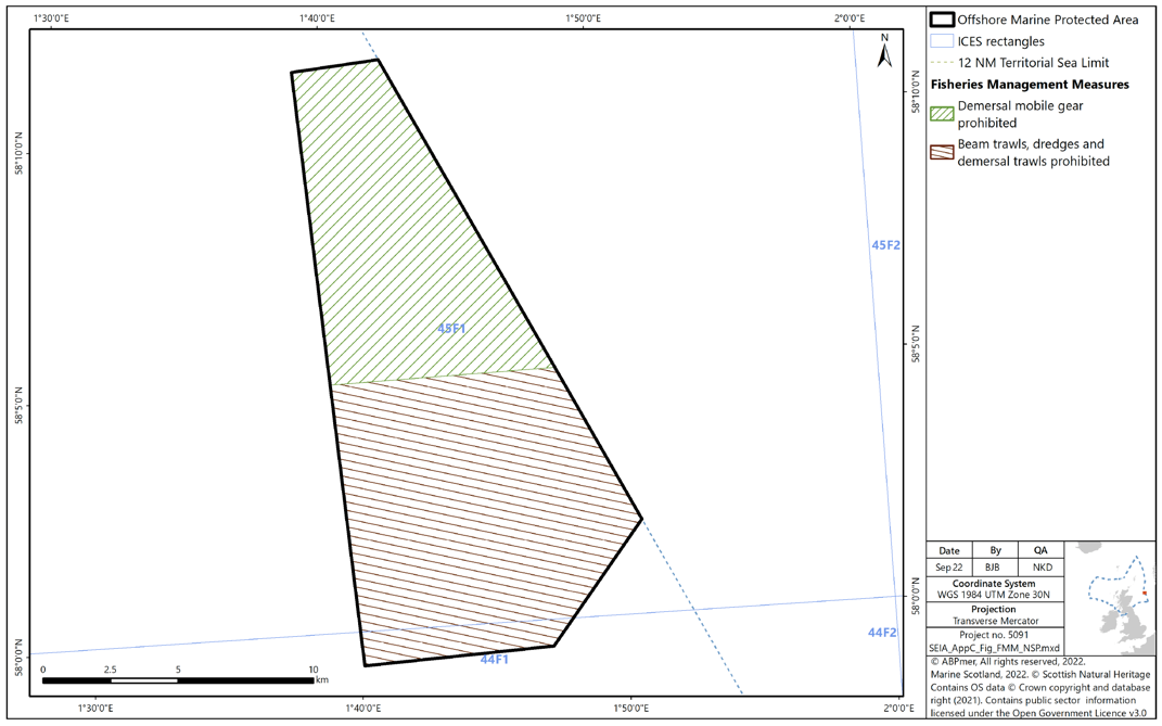
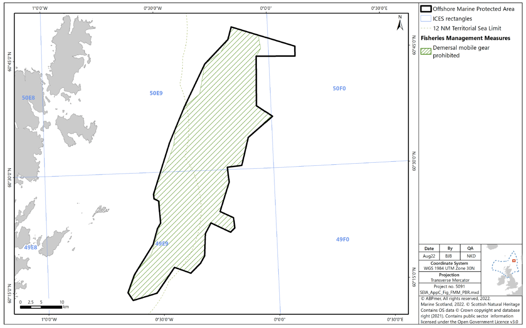
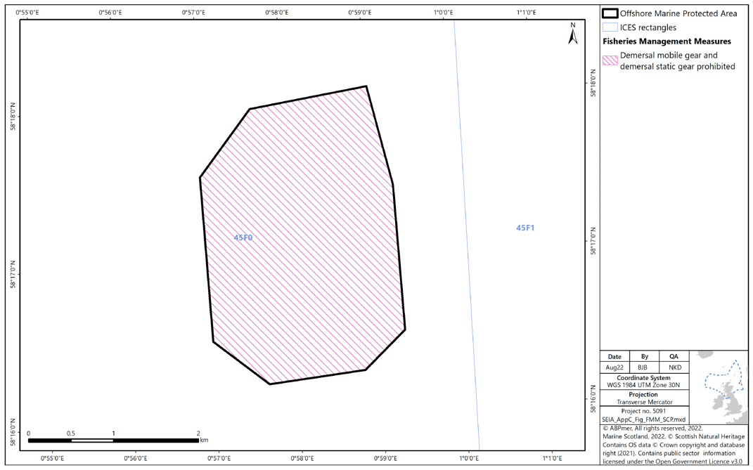
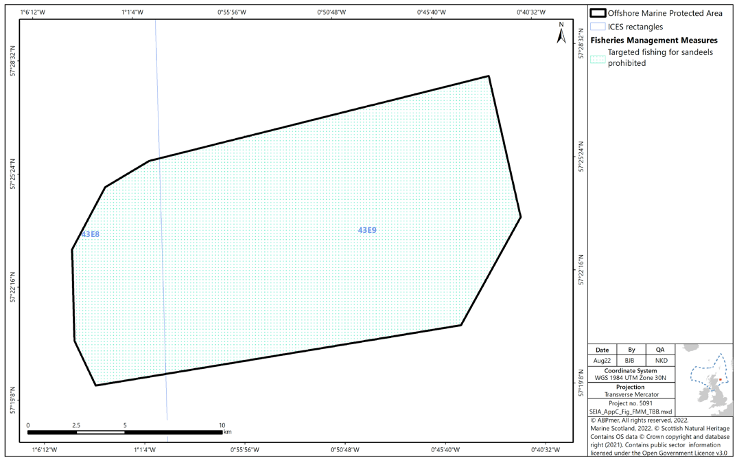
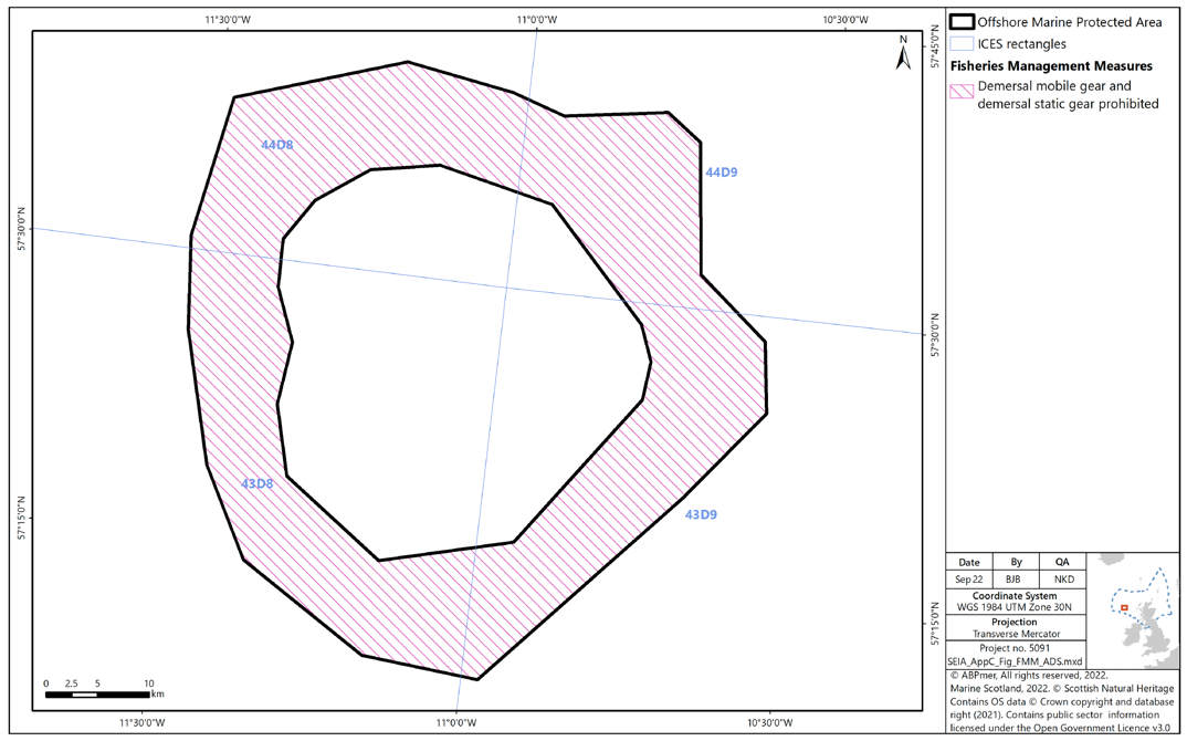
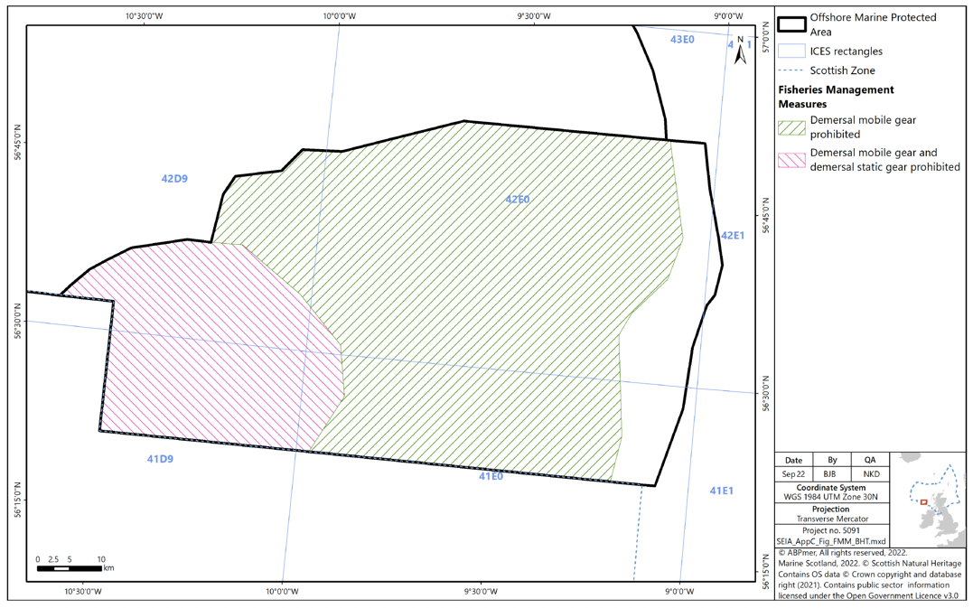
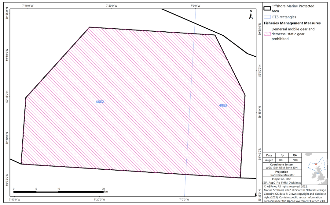
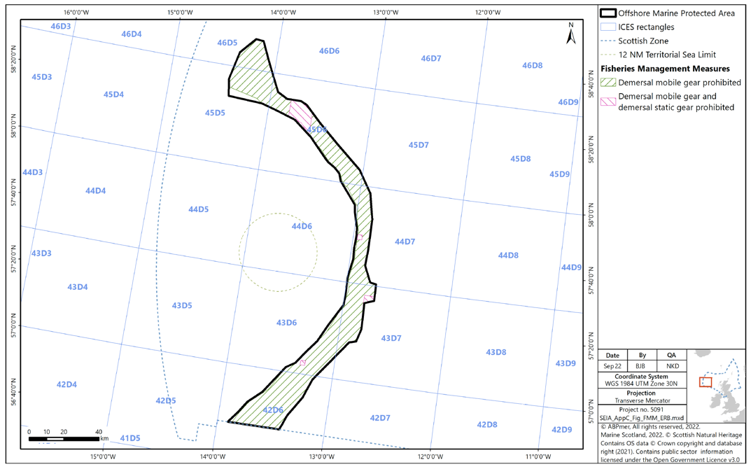
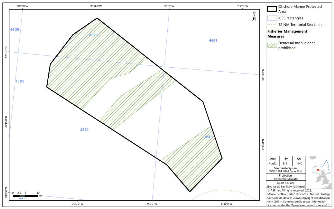
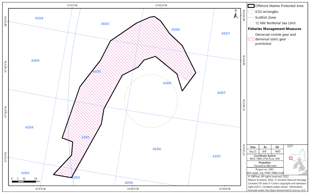
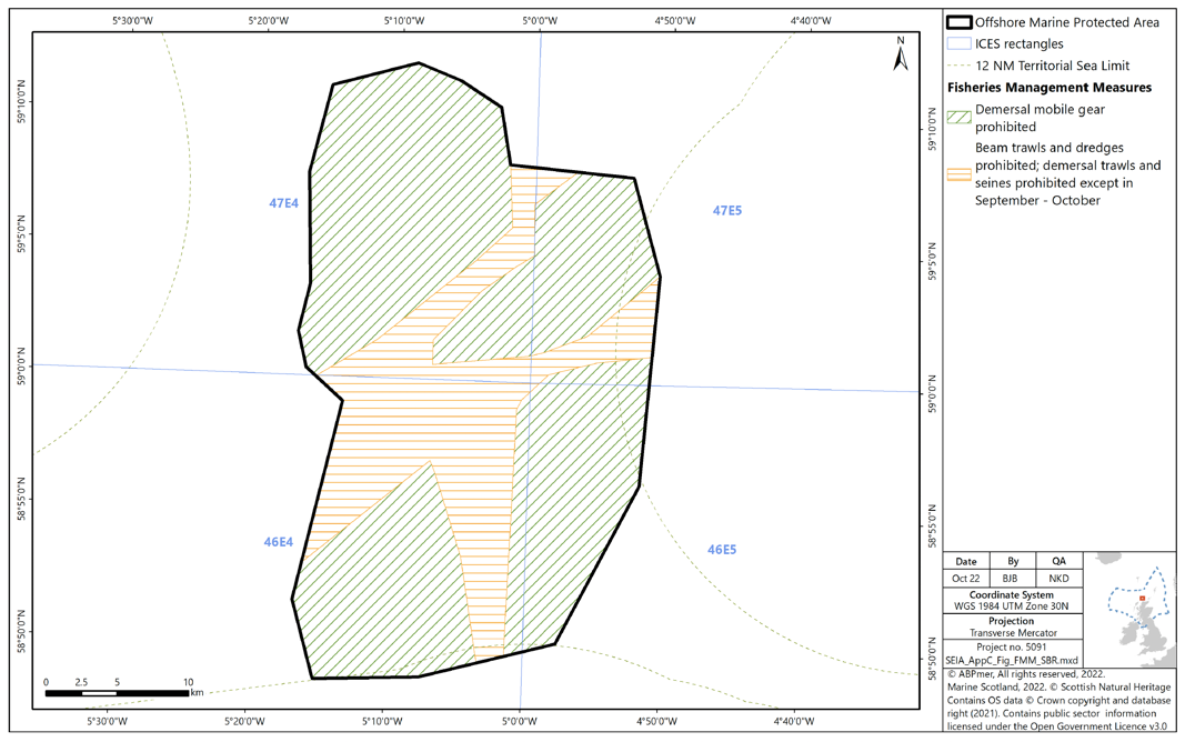
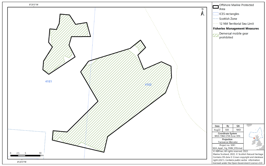
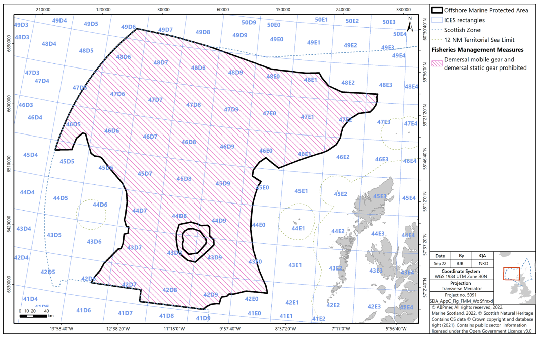
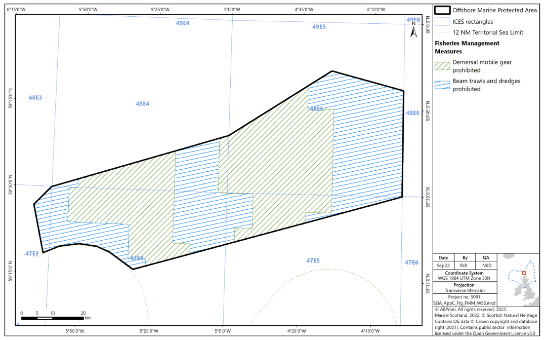
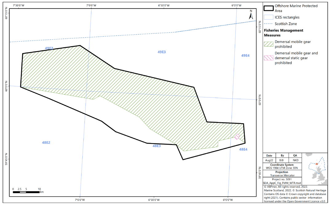
Appendix B Maps of Proposed Fisheries Management Measures in Offshore MPAs

Figure B1 Proposed management measures under Option 1 in Braemar Pockmarks SAC

Map of Braemar Pockmarks SAC showing  demersal mobile gear and demersal static gear to be prohibited across the entire site

Figure B2 Proposed management measures under Option 1 in Central Fladen MPA

Map of Central Fladen MPA showing demersal mobile gear to be prohibited in the northern tip, a large area in the southeast, and in the northeastern-most area

Figure B3 Proposed management measures under Option 1 in East of Gannet and Montrose Field MPA

Map of East of Gannet and Montrose Field MPA showing the northern and western area of the MPA (constituting roughly 2/3 of the MPA) prohibiting beam trawls, dredges, and demersal trawls. The southeastern remainder of the MPA prohibits beam trawls and dredges

Figure B4 Proposed management measures under Option 1 in Faroe-Shetland Sponge Belt MPA

Map of Faroe-Shetland Sponge Belt MPA showing the northwestern edge of the MPA as prohibiting demersal mobile gear, and the southeastern edge and parts of the centre in the north as prohibiting demersal mobile and static gear

Figure B5 Proposed management measures under Option 1 in Firth of Forth Banks Complex MPA

Map of Firth of Forth Banks Complex MPA , showing prohibition of beam trawls, dredges, and demersal trawls in the east of the northern sector, the south of the western sector, and all but the southern tip of the southern sector

Figure B6 Proposed management measures under Option 1 in Northeast Faroe-Shetland Channel MPA

Map of Northeast Faroe-Shetland Channel MPA , showing demersal mobile and demersal static gear as prohibited from the southern edge of the central southern protruding area, and demersal mobile gear prohibited from all areas other than the central southern protruding area

Figure B7 Proposed management measures under Option 1 in Norwegian Boundary Sediment Plain MPA

Map of Norwegian Boundary Sediment Plain MPA, demersal mobile gear is shown as prohibited from the northern half, while beam trawls, dredges, and demersal trawls are prohibited from the southern half

Figure B8 Proposed management measures under Option 1 in Pobie Bank Reef SAC

Map of Pobie Bank Reef SAC showing all areas but the northeastern protrusion, and two small areas on the western edges of the MPA as prohibiting all demersal mobile gear

Figure B9 Proposed management measures under Option 1 in Scanner Pockmark SAC

Map of Scanner Pockmark SAC showing demersal mobile and demersal static gear as prohibited from the entire SAC

Figure B10 Proposed management measures under Option 1 in Turbot Bank

Map of Turbot Bank MPA showing targeting fishing for sandeels as prohibited from the entire MPA

Figure B11 Proposed management measures under Option 1 in Anton Dohrn Seamount SAC

Map of Anton Dohrn Seamount SAC showing demersal mobile and demersal statice gear being prohibited from the entire site

Figure B12 Proposed management measures under Option 1 in Barra Fan and Hebrides Terrace Seamount MPA

Map of Barra Fan and Hebrides Terrace Seamount MPA, the southwestern area of the MPA is marked as prohibiting demersal mobile and demersal static gear. The remainder of the MPA bar the easternmost edge is marked as prohibiting demersal mobile egar

Figure B13 Proposed management measures under Option 1 in Darwin Mounds SAC

Map of Darwin Mounds SAC, with the entire MPA marked as prohibiting demersal mobile gear and demersal static gear

Figure B14 Proposed management measures under Option 1 in East Rockall Bank SAC

Map of East Rockall Bank SAC all but a sliver of the southern edge of the northwestern extent of the SAC is marked as prohibited for demersal mobile gear. Demersals tatic gear is also prohibited from a segment of the north, as well as small areas throughout the centre and south

Figure B15 Proposed management measures in under Option 1 Geikie Slide and Hebridean Slope MPA

Map of Geikie Slide and Hebridean Slope MPA , showing demersal mobile gear being prohibited from the northwest and southeast of the MPA, as well as a band through the centre

Figure B16 Proposed management measures under Option 1 in Northwest Rockall Bank SAC

Map of Northwest Rockall Bank SAC showing demersal mobile gear and demersal static gear being prohibited from all but the southern tip of the northeastern protrusion

Figure B17 Proposed management measures under Option 1 in Solan Bank Reef SAC

Map of Solan Bank Reef SAC showing beam trawls and dredges prohibited throughout the MPA, with demersal trawls and seines prohibited except during September and October. The Northwest and southeast of the MPA are prohibited for demersal mobile gear at all times, as are two areas protruding towards the centre from the northeast and southwest

Figure B18 Proposed management measures under Option 1 in Stanton Banks SAC

Map of Stanton Banks SAC showing prohibition of demersal mobile gear across almost all of both sectors of the MPA

Figure B19 Proposed management measures under Option 1 in West of Scotland MPA

Map of West of Scotland MPA showing demersal mobile and demersal static gear being prohibited across the MPA

Figure B20 Proposed management measures under Option 1 in West Shetland Shelf MPA

Map of West Shetland Shelf MPA showing beam trawls and dredges being prohibited across the MPA. All demersal mobile gear is prohibited in a large area around a third of the way in from the east, and another area covering all but the westernmost and southernmost extent of the western third of the MPA

Figure B21 Proposed management measures under Option 1 in Wyville-Thomson Ridge SAC

Map of Wyville-Thomson Ridge SAC showing demersal mobile gear being prohibited from all but the southern edge of the MPA. Demersal static gear is additionally prohibited from a small area in the east

Contact

Email: marine_biodiversity@gov.scot

Back to top